As of: 0641 LCL, SAT 13 NOV 2010
KIPT sunrise 0654, sunset 1650. Radar summary. NY Center WX (mouse over stations for METAR/TAF).
Sunday NWS KIPT forecast: Mostly sunny, with a high near 58. Calm wind becoming southeast around 6 mph.
KIPT 141130Z 1412/1512 11006KT P6SM FEW100 SCT200
     FM150600 15005KT P6SM BKN050 OVC100
KIPT 141054Z AUTO 00000KT 10SM CLR M02/M03 A3008 RMK AO2 SLP189 T10171033
Sunday NWS TGI forecast: Sunny, with a high near 61. Northeast wind around 8 mph.
KNHK 1409/1509 VRB04KT 9999 SKC QNH3003INS
     BECMG 1410/1412 10005KT SCT200 QNH2999INS
     TEMPO 1412/1418 BKN200
     BECMG 1504/1506 12005KT QNH2998INS AUTOMATED SENSOR METWATCH 1403 TIL 1411 T02/1409Z T16/1420Z
KNHK 141108Z AUTO 23003KT 7SM CLR 02/01 A3009 RMK AO2 VISNO RY24 $

KSBY 141121Z 1412/1512 03005KT P6SM BKN250
     FM142300 VRB02KT P6SM SCT250
KSBY 141054Z 00000KT 10SM CLR 00/M01 A3010 RMK AO2 SLP194 T00001011 $
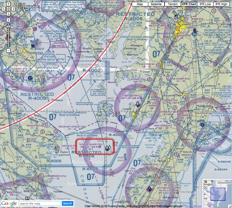
TGI has right traffic for Rwy 02. See R-6609 below! Stay on the east side of the airport.
There is no fuel at TGI. Plan accordingly, and see below, near the end.
TGI is surrounded by Restricted airspace, especially to the west. It is possible to fly into TGI, but when the Restricted areas are active, you must be either IFR, or VFR with flight-following. You must check NOTAMs. Notice especially R-6609 and R-4006.
R-6609 starts a mile to the west of TGI and according to GlobalSecurity.com:
Tangier Island Range (R-6609). R-6609 is an unattended/non-instrumented range located in Chesapeake Bay approximately 27 NMI south-southeast of the NAS Patuxent River VORTAC, Channel 123. R-6609 extends from the surface up to FL200. Air-to-ground exercises, including loft delivery, using MK 76 or MK 106 practice bombs, water/sand-filled bombs, practice bombs, and 2.75-inch FFARs with inert heads are authorized. Strafing is not authorized. The target consists of a 415-foot by 65-foot sunken cargo ship. R-6609 is available continuously.TGI lies just below R-4006:
R-4006 is special-use airspace located approximately 20 NMI east of the Patuxent VORTAC, Channel 123, bearing 090°. The airspace extends from 3500-feet MSL up to, but not including, FL250. R-4002, R-4005, and R-6609 are within, but excluded from, R-4006. R-4006 is utilized primarily for aircraft RDT&E exercises. No ordnance is authorized in this area. R-4006 is available continuously.
At the moment, R-4006 and R-6609 do not appear to be active, but check with FSS to be sure. I have provided this information for your convenience, but it is up to you, PIC, to verify its accuracy. The map below is provided courtesy of RunwayFinder:
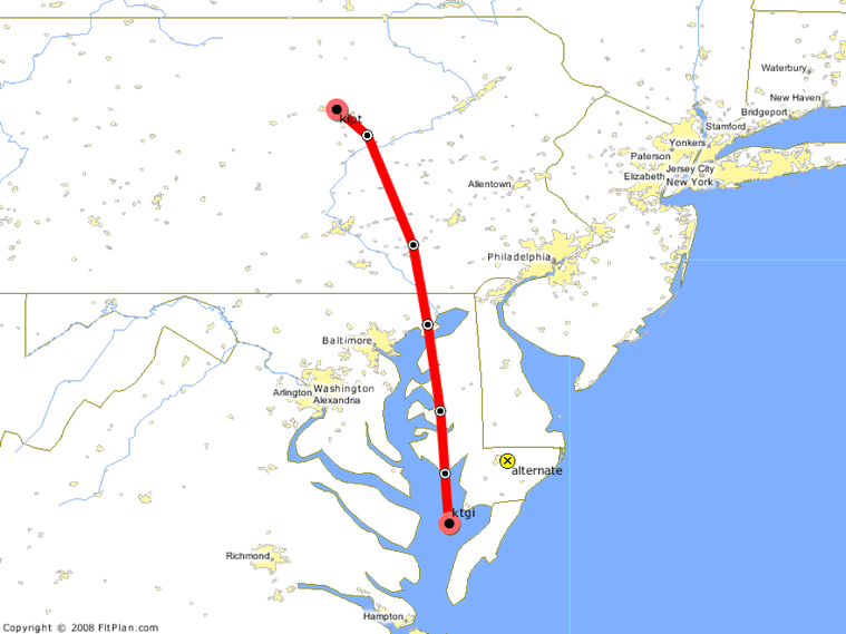
Here is the clearance that Michael received last time, in May 2007: MIP LRP PPM BILIT. It calculates as 214nm vs 210nm direct. Note however that we have a new Vice President with a TFR over his house, between the Modena MXE and DuPont DQO VORs. Do not violate that TFR!
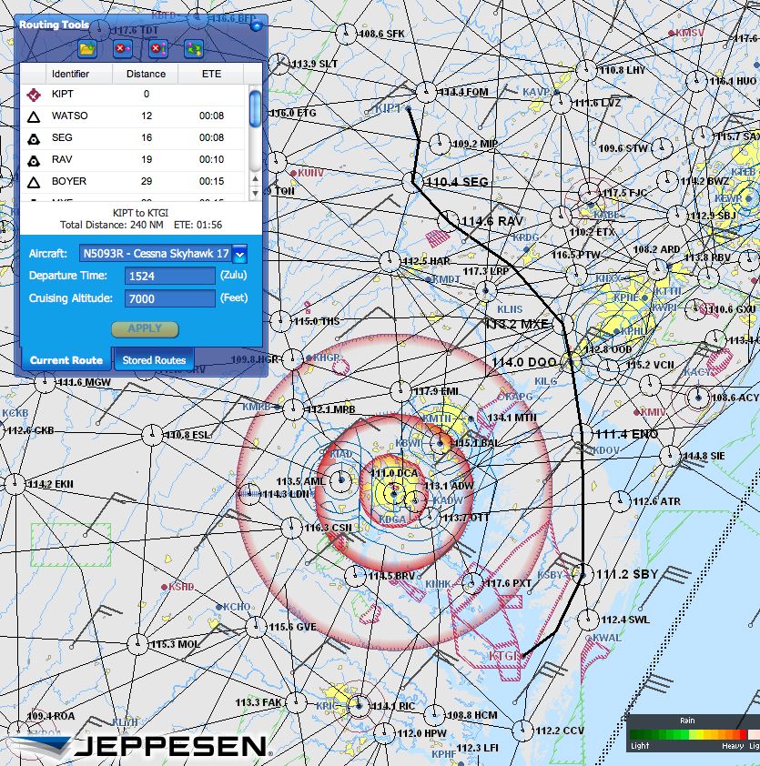
Using the AOPA flight planner (IFR Low Airways), when I plugged in KIPT to TGI for 93R, I got a route of 240nm:
There is no fuel at TGI. Stay tuned for a table listing nearby airports with fuel, and prices. Meanwhile, good options for fuel are W41 (Crisfield, MD) and KSBY (Salisbury, MD)
Photos from the 2007-05-05 TGI fly-out.